Built in large part by prisoners with hand tools between 1913 and 1917, the Fall River Road in Rocky Mountain National Park offers stunning views that harken back to the earliest days of auto touring in the U.S.
Work stopped in 1917 with the entry of the United States into World War I, and a contractor took over in 1918. The road opened to motor vehicle traffic in 1920, allowing passage from Estes Park to Grand Lake and the Kawuneeche Valley.

Trail Ridge Road was constructed in the early 1930s, utilizing the western half of the Fall River Road from Fall River Pass and a new eastern approach along Trail Ridge. The new approach allowed for fewer switchbacks and a gentler grade, while achieving greater altitude and (some would say) more impressive views.
The Old Road, as it is sometimes referred to by park staff, follows Fall River and switchbacks up the face of Mount Chapin, the southern tip of the Mummy Range, from West Horseshoe Park. Some time prior to a 1968 reconstruction effort, the road was paved to the Endovalley picnic area.

Once over Fall River Pass, the Alpine Visitor Center is at the junction with Trail Ridge Road, leading back down Trail Ridge to West Horseshoe Park, or west to the foot of the Never Summer Range and, eventually, Lake Granby.
Initially called the “Fall River Highway,” the road was built by the State of Colorado under an agreement with the U.S. federal government to maintain it in a time when Grand and Larimer counties were hoping to attract tourists to the “Switzerland of the Rockies.”

Period newspaper stories reported the round trip from Denver, through Estes Park and Grand Lake, and back over Berthoud Pass, took just two or three days, and called it “one of the greatest circle trips in the world — a trip which, it is predicted, will make Denver more famous the world over.”
Fall River Road is open seasonally depending on weather — often opening in late July and remaining passable for just a few months before snows close the road, which is not plowed. After the road closes to vehicles, it remains open to bikes and hikers until November, and provides a trail for snowshoeing and cross-country skiing through winter.

Currently, vehicular travel is limited to one direction: up. Trailers and large RVs are prohibited due to the needle-tight curves on some switchbacks. On my trip I saw full-size pickup trucks require three-point turns on several switchbacks, though the Jeep handled them without even hitting the limits of its turn radius.
Rocky Mountain National Park covers 76 square miles of prime Colorado Rocky Mountain real estate, and was established in 1915 by President Woodrow Wilson. The Beaver Meadows Visitor Center, which houses the park’s headquarters, was designed by the Frank Lloyd Wright School of Architecture at Taliesin West.

The park is largely surrounded by National Forest and Wilderness land, and is a UNESCO World Biosphere Reserve.
To reach the Fall River Road, approach the park from Estes Park via the Fall River Entrance Station and follow the signs for the Alluvial Fan. Lawn Lake Dam, built in 1903 by Loveland farmers to increase the surface height of the existing natural lake, failed spectacularly in 1982, killing three park visitors, causing $31 million in flood damage to the town of Estes Park, and depositing the Alluvial Fan.
Hikers can walk far up the Alluvial Fan to see Horseshoe Falls, where the Roaring River, exiting Lawn Lake, drops nearly 500 feet in a series of rapids and short drops from its hanging valley to join the Fall River below.
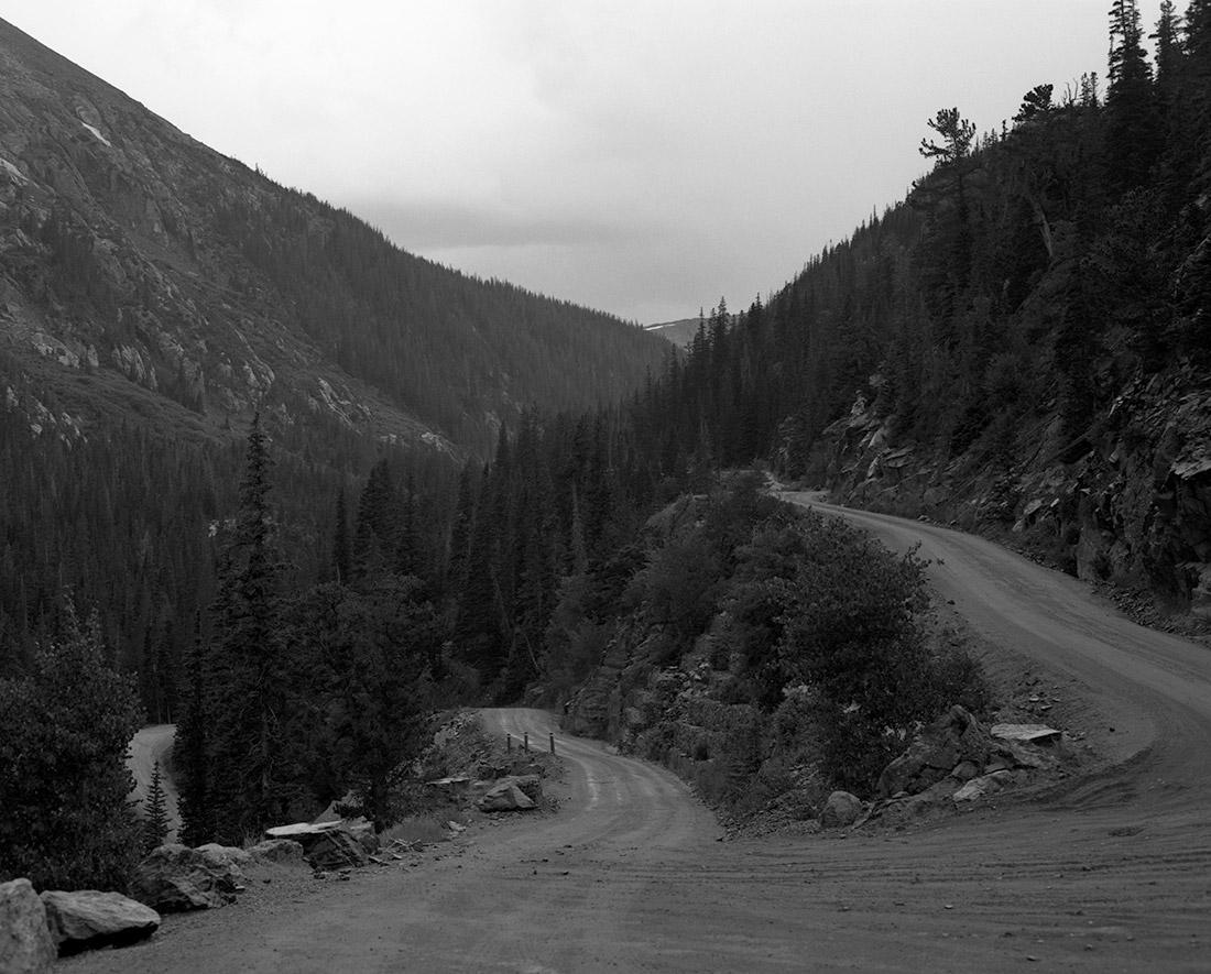
Beyond the Alluvial Fan and the Endovalley picnic area, the pavement ends and single-direction traffic begins on the 8-to-10-foot-wide gravel road. There are no guard rails and grades are mostly 8 or 10 percent, though they can be as steep as 15 percent at switchback turns.

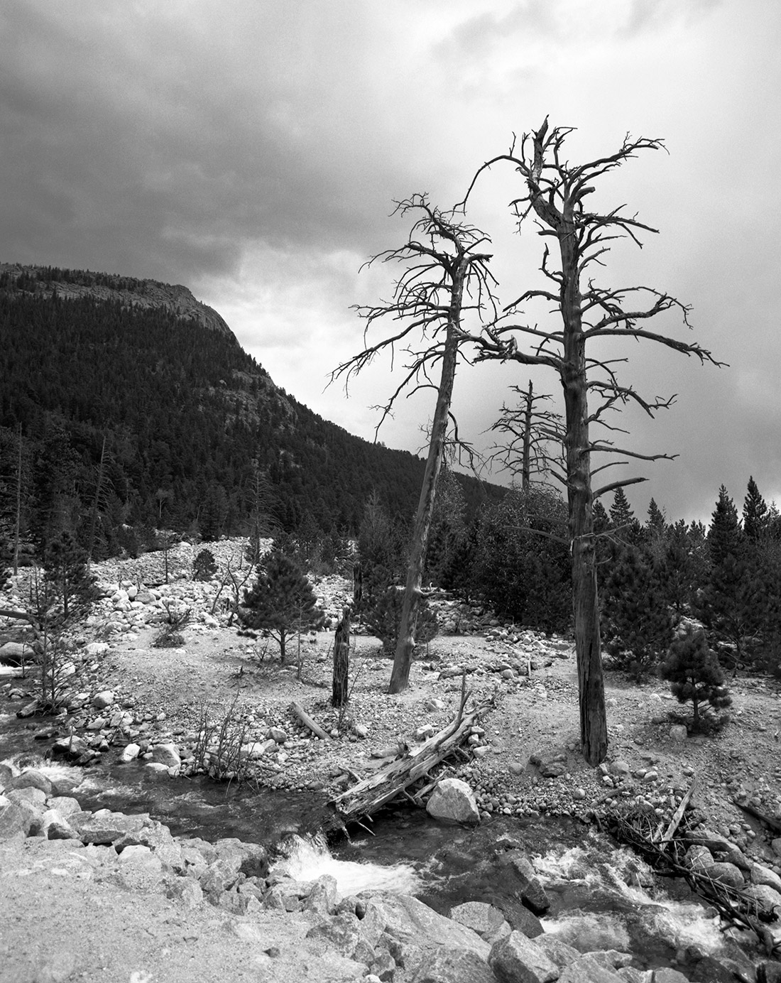
Along the way there are plenty of turnoffs and wide spots to pull over and take in the surroundings. There are several short hiking trails, as well, including one that offers close-up viewing of one of the many short falls on Fall River.
Chasm Falls bursts through a narrow slit in the rock floor of the valley and drops about 25 feet to a narrow, deep fall pool. The hike is really more of a walk, and takes just a few minutes to descend a hundred or so loosely connected steps. Beware: parking is at a premium in the pull-off, and the rock steps can be extremely slippery if wet.

Climbing further up the road, the switchbacks become tighter and more frequent as you approach the origin of Fall River — Fall River Cirque, a bowl nearly a mile across and over 1,000 feet deep from the top of Trail Ridge to the southwest. Herds of elk can frequently be seen in the cirque, drinking from the alpine pools where snowmelt gathers — year round, for the snowpack on the north face of Trail Ridge rarely melts completely — to feed the river.
Just before the summit of the pass, two short trails lead up Chapin Creek and higher on the slope of Mount Chapin, and offer further views of the Mummy Range and Trail Ridge.

From the top of Fall River Pass, you can see down the Fall River Valley all the way to Estes Park and beyond. The Alpine Visitor Center, just off the pass, sits at 11,796 feet above sea level — and several hundred feet above treeline, too.
From the Visitor Center, join Trail Ridge road and head east back to Estes Park or west to Grand Lake — either direction offers further views.
I chose to head back to Estes Park and stopped at every turnoff I saw — at least half a dozen. Views across Forest Canyon stunningly showcase the mountains that make up this stretch of the Continental Divide, including Terra Tomah Mountain and Stones Peak.

Heading this direction you’ll cross Milner and Iceberg passes, and traverse the highest point on the road — at 12,183 feet — near the Lava Cliffs. Don’t miss the Rock Cut and Forest Canyon turnoffs on either side of Sundance Mountain, offering views of the Gorge Lakes, nestled between Mounts Ida and Julien in an especially large cirque.
Further down the road makes a large arc around Hidden Valley before turning back on itself at Many Parks Curve. Passing Beaver Ponds, it then reaches Deer Ridge Junction, where drivers can return to West Horseshoe Park to the north or head south through Moraine Park and Beaver Meadows.

These photographs were all made in a one-day drive on Oct. 24, 2016, a few days before the road closed for the season — later than usual due to the long and temperate autumn in Colorado this year. I used my Pentax 6×7 and a variety of lenses. It was the first serious outing for the 300mm f/4 lens, and it performed admirably.
I also used a variety of films, including an expired roll of Fuji Velvia that turned out a touch dark, but not too badly. The roll of Agfa Optima 200 I tried was extremely disappointing, as I exposed it at EI50 and still found my results at least a full stop underexposed. Rolls of fresh Ilford Pan F Plus and well-stored Kodak Portra 160NC fared far better.
Most of the park’s geologic beauty was carved by glaciers over millions of years. A 1916 geologic guide republished by the National Parks Service takes readers on a tour beginning in Estes Park.

Additional resources:
- Rocky Mountain National Park Map (PDF)
- Rocky Mountain National Park at NPS.gov
- Old Fall River Road at NPS.gov
- RMNP wildlife guide
- Fall River Road on the National Register of Historic Places
Note: I found, after making the image at the top of this post, a very similar one from the Historic American Engineering Record at the Library of Congress.
